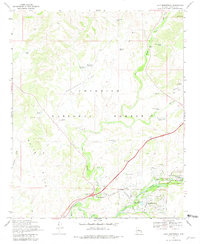
1969 Map of Lake Montezuma
USGS Topo · Published 1981About this map
Montezuma Castle National Monument and the surrounding Verde Valley landscape highlight this 1969 survey, detailing the transition from ancient heritage to mid-century development. The map prominently features Montezuma Castle and the nearby Montezuma Well, alongside the residential growth of Lake Montezuma with its local streets like Geronimo Rd and Valley Vista Rd. This period documents the intersection of modern infrastructure and rural outposts, where the McGuireville Interchange connects to older landmarks like the Rimrock PO and Apache Maid Ranch. The geography is defined by the seasonal flow of Dry Beaver Creek and Wet Beaver Creek as they cut through the White Hills and Beaverhead Flat. Local life is further evidenced by the Beaver Creek Sch and the small Rimrock Airport, providing a clear view of Yavapai County just as Interstate travel was reshaping the region.
Find a feature on this map
55 named features on this map. Tap any name to fly to it.
Don’t see what you’re looking for? This feature index may not catch every label — zoom into the map to look around manually.
Map Details
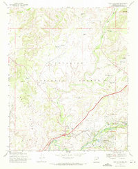
Editions of this 1969 Lake Montezuma Map
2 editions found
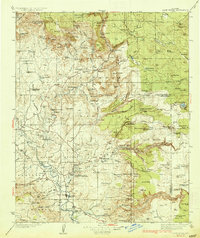
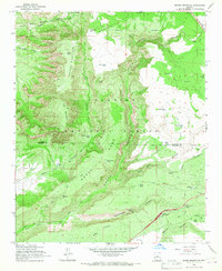
Other maps of this area

1887 · Verde
USGS Topo · 1:250,000

1892 · Verde
USGS Topo · 1:250,000

1923 · Camp Verde
USGS Topo · 1:125,000

1932 · Camp Verde
USGS Topo · 1:125,000
1936 · Camp Verde
USGS Topo · 1:125,000

1954 · Holbrook
USGS Topo · 1:250,000

1957 · Holbrook
USGS Topo · 1:250,000

1958 · Holbrook
USGS Topo · 1:250,000

1960 · Holbrook
USGS Topo · 1:250,000
1965 · Munds Mountain
USGS Topo · 1:24,000