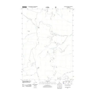
2011 Map of Lake Mountain
USGS Topo · Published 2011About this map
Lake Mountain and the surrounding high country of Lemhi County define this landscape of steep drainages and mountain passes. The map documents a complex network of US Forest Service roads, including Moccasin Creek Rd and Ridge Rd, which provide access to the ridge tops and creek bottoms. The geography is dominated by major watercourses such as North Fork Williams Creek and South Fork Williams Creek, which flow through the central portion of the quadrangle. High-altitude points of interest include Williams Creek Summit and Deep Creek Ridge, offering insights into the natural corridors used for navigation through the Salmon River Mountains. Evidence of human activity is found at the Peterson Ranch, while hydrologic features like China Spring and Lake Creek highlight the water sources critical to this high-elevation environment.
Find a feature on this map
22 named features on this map. Tap any name to fly to it.
Don’t see what you’re looking for? This feature index may not catch every label — zoom into the map to look around manually.
Map Details
Editions of this 2011 Lake Mountain Map
This is the sole edition of this map. No revisions or reprints were ever made.
Other maps of this area

1950 · Salmon
USGS Topo · 1:62,500

1950 · Leesburg
USGS Topo · 1:62,500

1951 · Leesburg
USGS Topo · 1:62,500

1951 · Salmon
USGS Topo · 1:62,500

1955 · Dubois
USGS Topo · 1:250,000

1955 · Dillon
USGS Topo · 1:250,000

1956 · Elk City
USGS Topo · 1:250,000

1957 · Dillon
USGS Topo · 1:250,000

1957 · Challis
USGS Topo · 1:250,000

1958 · Dubois
USGS Topo · 1:250,000