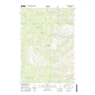
2017 Map of Lake Mountain
USGS Topo · Published 2017About this map
Salmon National Forest dominates this high-altitude terrain in the Salmon River Mountains, where the landscape is defined by the steep drainages of Williams Creek and Deep Creek. The map documents a complex network of forest roads and trails, including the Thunder Mountain Historic Ridge Rd and the Ridge Road to Iron Lake, reflecting the region's legacy of remote access and mountain transit. Key landmarks like Williams Creek Summit and Lake Mountain provide orientation in a territory marked by localized features such as China Spring and Perreau Meadows. This 2017 survey details the hydrological patterns of several forks, including the N Fork Williams Cr and S Fork Williams Cr, illustrating how the watershed shapes the rugged topography of Lemhi County.
Find a feature on this map
51 named features on this map. Tap any name to fly to it.
Don’t see what you’re looking for? This feature index may not catch every label — zoom into the map to look around manually.
Map Details
Editions of this 2017 Lake Mountain Map
This is the sole edition of this map. No revisions or reprints were ever made.
Other maps of this area

1950 · Salmon
USGS Topo · 1:62,500

1950 · Leesburg
USGS Topo · 1:62,500

1951 · Leesburg
USGS Topo · 1:62,500

1951 · Salmon
USGS Topo · 1:62,500

1955 · Dubois
USGS Topo · 1:250,000

1955 · Dillon
USGS Topo · 1:250,000

1956 · Elk City
USGS Topo · 1:250,000

1957 · Dillon
USGS Topo · 1:250,000

1957 · Challis
USGS Topo · 1:250,000

1958 · Dubois
USGS Topo · 1:250,000