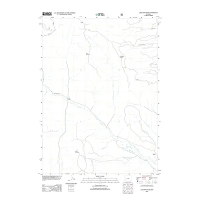
2012 Map of Lake Mountain
USGS Topo · Published 2012About this map
Lake Mountain and Miller Mountain anchor this high-country landscape in Lincoln County, where the drainages of the La Barge Cr and Rock Cr carve through the terrain. The small settlement of Viola is situated near the southeastern edge of the map, marking a rare point of human habitation in a region defined by its complex network of seasonal creeks and gulches. Significant topographic landmarks like Deadline Ridge and Long Hollow illustrate the rugged character of the area, which is accessed via remote routes such as La Barge Creek Rd and Beaver Dam Creek Rd. The drainage patterns, including Chapel Cr and Grassy Hollow Cr, suggest a land shaped by the heavy runoff of the Wyoming high desert and mountain foothills, providing a clear picture of the hydrological geography as it existed in the early 21st century.
Find a feature on this map
23 named features on this map. Tap any name to fly to it.
Don’t see what you’re looking for? This feature index may not catch every label — zoom into the map to look around manually.
Map Details
Editions of this 2012 Lake Mountain Map
This is the sole edition of this map. No revisions or reprints were ever made.
Other maps of this area

1936 · Cokeville
USGS Topo · 1:96,000

1942 · Cokeville
USGS Topo · 1:125,000

1945 · Fort Hill
USGS Topo · 1:62,500

1947 · Fort Hill
USGS Topo · 1:62,500

1955 · Preston
USGS Topo · 1:250,000

1958 · Preston
USGS Topo · 1:250,000

1962 · Preston
USGS Topo · 1:250,000
1967 · Coal Creek
USGS Topo · 1:24,000

1967 · Mount Thompson
USGS Topo · 1:24,000
1967 · Fontenelle Basin
USGS Topo · 1:24,000