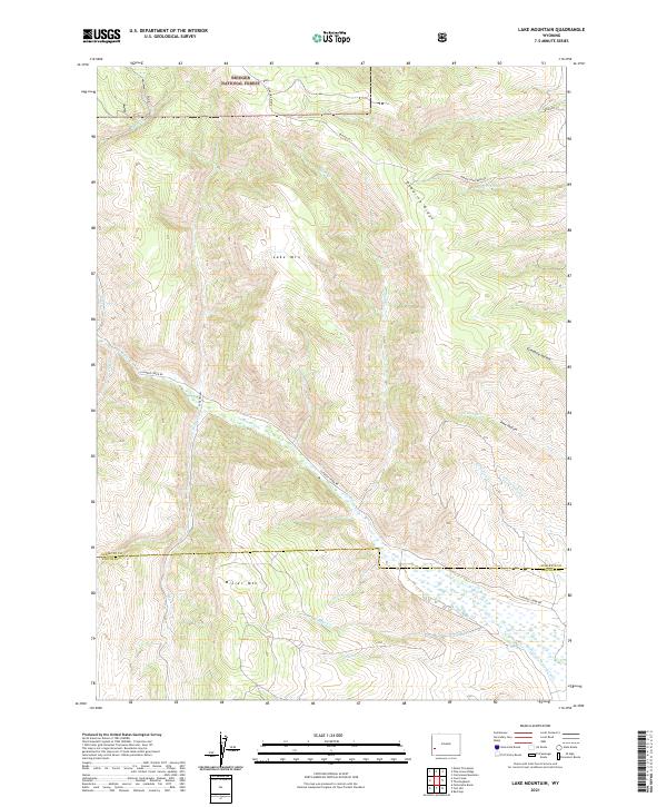
2021 Map of Lake Mountain
USGS Topo · Published 2021About this map
The high ridges and drainage basins of the Bridger National Forest define this landscape along the border of Sublette and Lincoln counties. Dominating the topography are the massive heights of Lake Mountain and Miller Mountain, which rise sharply above the intersecting valleys. The map illustrates a complex network of seasonal and perennial waterways including La Barge Creek and Beaver Dam Creek, which flow through the deep recesses of Graphite Hollow and Pine Hollow.
Find a feature on this map
31 named features on this map. Tap any name to fly to it.
Don’t see what you’re looking for? This feature index may not catch every label — zoom into the map to look around manually.
Map Details
Editions of this 2021 Lake Mountain Map
This is the sole edition of this map. No revisions or reprints were ever made.
Other maps of this area

1936 · Cokeville
USGS Topo · 1:96,000

1942 · Cokeville
USGS Topo · 1:125,000

1945 · Fort Hill
USGS Topo · 1:62,500

1947 · Fort Hill
USGS Topo · 1:62,500

1955 · Preston
USGS Topo · 1:250,000

1958 · Preston
USGS Topo · 1:250,000

1962 · Preston
USGS Topo · 1:250,000
1967 · Coal Creek
USGS Topo · 1:24,000

1967 · Mount Thompson
USGS Topo · 1:24,000
1967 · Fontenelle Basin
USGS Topo · 1:24,000