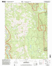
1997 Map of Lake Mountain
USGS Topo · Published 2001About this map
Lake Mountain serves as the central anchor for this mountainous region of Trinity County, where the topography is defined by the high ridges of Haman Ridge and the Fenton Ridge. Private holdings like Jamison Ranch and Lampley Ranch are scattered throughout the Six Rivers National Forest, indicating a long-standing history of ranching and remote settlement. The landscape is characterized by its hydrological complexity, featuring numerous unnamed Springs and named catchments like Turtle Lake and Lost Lake. Traces of small-scale industry appear at the Prospect Mines, while the presence of the Lake Mountain Landing Strip and Frazier Gardens suggests localized infrastructure and subsistence in this high-elevation terrain. To the west, the river system cuts deeply, notably at Island Mountain, while high points such as Pilot Peak and Horse Ranch Peak provide prominent landmarks across the quadrangle.
Find a feature on this map
41 named features on this map. Tap any name to fly to it.
Don’t see what you’re looking for? This feature index may not catch every label — zoom into the map to look around manually.
Map Details
Editions of this 1997 Lake Mountain Map
This is the sole edition of this map. No revisions or reprints were ever made.
Other maps of this area

1920 · Cummings
USGS Topo · 1:62,500

1920 · Covelo
USGS Topo · 1:62,500

1920 · Harris
USGS Topo · 1:62,500

1921 · Hoaglin
USGS Topo · 1:62,500

1922 · Island Mountain
USGS Topo · 1:62,500

1931 · Hoaglin
USGS Topo · 1:96,000

1935 · Hoaglin
USGS Topo · 1:125,000

1949 · Alderpoint
USGS Topo · 1:62,500

1951 · Alderpoint
USGS Topo · 1:62,500

1952 · Spyrock
USGS Topo · 1:62,500