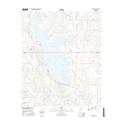
2016 Map of Lake Murray
USGS Topo · Published 2016About this map
Lake Murray dominates the landscape of southern Oklahoma in this 2016 survey, its irregular shoreline reaching north through the West Anadarche Arm and East Anadarche Arm. The map documents the boundary between Carter and Love counties, which bisects the lake just south of Hoxbar. To the west, the Lake Murray State Park Airport and Tipps Point mark the recreational infrastructure developed around the reservoir.
Find a feature on this map
72 named features on this map. Tap any name to fly to it.
Don’t see what you’re looking for? This feature index may not catch every label — zoom into the map to look around manually.
Map Details
Editions of this 2016 Lake Murray Map
This is the sole edition of this map. No revisions or reprints were ever made.
Other maps of this area

1901 · Tishomingo
USGS Topo · 1:125,000

1901 · Ardmore
USGS Topo · 1:125,000

1901 · Denison
USGS Topo · 1:125,000

1902 · Gainesville
USGS Topo · 1:125,000

1918 · Ardmore
USGS Topo · 1:125,000

1943 · Gainesville
USGS Topo · 1:125,000

1954 · Sherman
USGS Topo · 1:250,000

1957 · Ardmore
USGS Topo · 1:250,000

1958 · Gordonville
USGS Topo · 1:62,500

1958 · Sherman
USGS Topo · 1:250,000