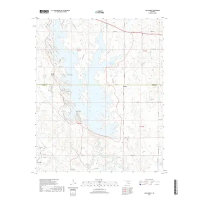
2018 Map of Lake Murray
USGS Topo · Published 2018About this map
Lake Murray dominates the landscape of southern Oklahoma in this 2018 survey, its jagged shoreline branching into distinct inlets like the West Anadarche Arm and Fourche Maline Arm. The map reveals a transition between the recreational development of the state park and the rural heritage of Love and Carter Counties. While the Lake Murray State Park Airport and landmarks like Tucker Tower reflect the area's role as a regional destination, the surrounding lands maintain deep roots. Small settlements such as Hoxbar and Greenville anchor the map, surrounded by family-named landscape features and historic burial grounds. Genealogists and local historians can trace the distribution of sites like Legate Cem, Wilson Cem, and Ran Cem, which sit among the drainages of Hickory Creek and Pumpkin Cr.
Find a feature on this map
79 named features on this map. Tap any name to fly to it.
Don’t see what you’re looking for? This feature index may not catch every label — zoom into the map to look around manually.
Map Details
Editions of this 2018 Lake Murray Map
This is the sole edition of this map. No revisions or reprints were ever made.
Other maps of this area

1901 · Tishomingo
USGS Topo · 1:125,000

1901 · Ardmore
USGS Topo · 1:125,000

1901 · Denison
USGS Topo · 1:125,000

1902 · Gainesville
USGS Topo · 1:125,000

1918 · Ardmore
USGS Topo · 1:125,000

1943 · Gainesville
USGS Topo · 1:125,000

1954 · Sherman
USGS Topo · 1:250,000

1957 · Ardmore
USGS Topo · 1:250,000

1958 · Gordonville
USGS Topo · 1:62,500

1958 · Sherman
USGS Topo · 1:250,000