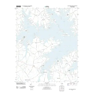
2011 Map of Lake Murray West
USGS Topo · Published 2011About this map
Lake Murray dominates this landscape, its sprawling fingers and inlets creating a complex shoreline that has reshaped the local geography of Lexington County. The map details how modern residential developments and recreation areas have integrated with older rural landmarks. Evidence of the area's agricultural and familial roots remains visible in the numerous small burial grounds scattered across the terrain, including the Macedonia Cemetery, Old Lexington Cemetery, and the Sease Cemetery near the Longview Plant.
Find a feature on this map
151 named features on this map. Tap any name to fly to it.
Don’t see what you’re looking for? This feature index may not catch every label — zoom into the map to look around manually.
Map Details
Editions of this 2011 Lake Murray West Map
This is the sole edition of this map. No revisions or reprints were ever made.
Other maps of this area

1904 · Columbia
USGS Topo · 1:125,000

1941 · Spartanburg
USGS Topo · 1:250,000

1944 · Gilbert
USGS Topo · 1:62,500

1953 · Spartanburg
USGS Topo · 1:250,000

1954 · Augusta
USGS Topo · 1:250,000

1957 · Augusta
USGS Topo · 1:250,000

1958 · Augusta
USGS Topo · 1:250,000

1960 · Spartanburg
USGS Topo · 1:250,000

1961 · Augusta
USGS Topo · 1:250,000

1962 · Augusta
USGS Topo · 1:250,000