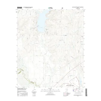
2016 Map of Lake Nacogdoches South
USGS Topo · Published 2016About this map
Lake Nacogdoches and its surrounding woodlands define the landscape of this East Texas region, where the borders of Nacogdoches, Cherokee, and Angelina counties meet. This survey highlights the complex drainage system feeding into the Angelina River, characterized by the winding Bayou Loco and the Old River Channel. The settlement of Alazan sits near the eastern edge, surrounded by local landmarks like Alazan Lake and Bonaldo Creek. Genealogists will find several notable burial sites throughout the area, including Eden Cemetery and Watson Cemetery near the lake's western shores, and Gravel Ridge Cemetery further east. Much of the southern terrain is protected within the Angelina National Forest, where a network of rural roads like Gravel Ridge Road and Wide Road connect scattered family-named features and local landmarks such as Tank Johnson Lake.
Find a feature on this map
64 named features on this map. Tap any name to fly to it.
Don’t see what you’re looking for? This feature index may not catch every label — zoom into the map to look around manually.
Map Details
Editions of this 2016 Lake Nacogdoches South Map
This is the sole edition of this map. No revisions or reprints were ever made.
Other maps of this area

1949 · Lufkin
USGS Topo · 1:62,500

1949 · Clawson
USGS Topo · 1:24,000

1950 · Clawson
USGS Topo · 1:24,000

1950 · Redland
USGS Topo · 1:24,000

1951 · Wells
USGS Topo · 1:24,000

1952 · Douglass
USGS Topo · 1:62,500

1952 · Nacogdoches
USGS Topo · 1:62,500

1953 · Palestine
USGS Topo · 1:250,000

1957 · Palestine
USGS Topo · 1:250,000
1983 · Durst Lakes
USGS Topo · 1:24,000