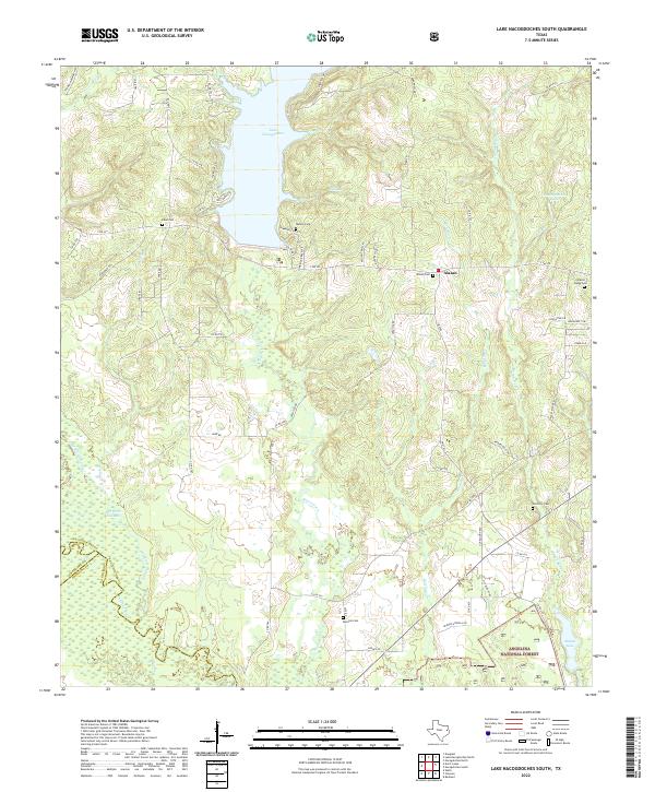
2022 Map of Lake Nacogdoches South
USGS Topo · Published 2022About this map
Lake Nacogdoches dominates the northern reaches of this East Texas terrain, where the waters are fed by drainage from Mill Cr and Mill Br. The landscape transitions from the residential developments of Cambridge Bay Ests and Shoreline Dr near the water to the protected woodlands of the Angelina National Forest in the south. This modern survey illustrates the complex water network of the region, tracing the winding paths of Bayou Loco, Alazan Bayou, and Bonaldo Cr as they weave through the county lines of Nacogdoches Co, Cherokee Co, and Angelina Co. For genealogists, the map preserves the locations of several burial grounds that anchor the rural community, including Eden Cem, Watson Cem, and Harmony Cem. These sites, along with the settlement of Alazan, reflect the deep-rooted local history of this forested river valley.
Find a feature on this map
66 named features on this map. Tap any name to fly to it.
Don’t see what you’re looking for? This feature index may not catch every label — zoom into the map to look around manually.
Map Details
Editions of this 2022 Lake Nacogdoches South Map
This is the sole edition of this map. No revisions or reprints were ever made.
Other maps of this area

1949 · Lufkin
USGS Topo · 1:62,500

1949 · Clawson
USGS Topo · 1:24,000

1950 · Clawson
USGS Topo · 1:24,000

1950 · Redland
USGS Topo · 1:24,000

1951 · Wells
USGS Topo · 1:24,000

1952 · Douglass
USGS Topo · 1:62,500

1952 · Nacogdoches
USGS Topo · 1:62,500

1953 · Palestine
USGS Topo · 1:250,000

1957 · Palestine
USGS Topo · 1:250,000
1983 · Durst Lakes
USGS Topo · 1:24,000