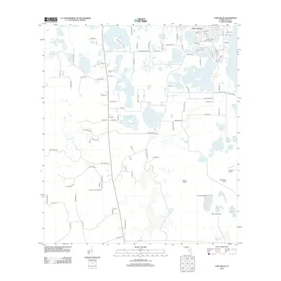
2012 Map of Lake Nellie
USGS Topo · Published 2012About this map
South Clermont serves as the primary residential anchor in this watery corridor of Central Florida, characterized by an intricate network of interconnected basins and wetlands. The landscape is dominated by large bodies of water such as Lake Nellie, Lake Louisa, and Pretty Lake, which define the local geography and transport patterns. These lakes are punctuated by distinct landforms like Black Jack Island and Wolf Bend Island, illustrating the complex hydrology of the region before further modern subdivision.
Find a feature on this map
112 named features on this map. Tap any name to fly to it.
Don’t see what you’re looking for? This feature index may not catch every label — zoom into the map to look around manually.
Map Details
Editions of this 2012 Lake Nellie Map
This is the sole edition of this map. No revisions or reprints were ever made.
Other maps of this area

1955 · Orlando
USGS Topo · 1:250,000

1957 · Orlando
USGS Topo · 1:250,000

1958 · Orlando
USGS Topo · 1:250,000

1959 · Lake Nellie
USGS Topo · 1:24,000

1959 · Lake Louisa
USGS Topo · 1:24,000

1959 · Lake Louisa SW
USGS Topo · 1:24,000

1959 · Poyner
USGS Topo · 1:24,000
1960 · Bay Lake
USGS Topo · 1:24,000
1960 · Rock Ridge
USGS Topo · 1:24,000

1962 · Orlando
USGS Topo · 1:250,000