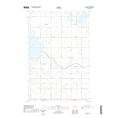
2018 Map of Lake Nettie
USGS Topo · Published 2018About this map
Glacial prairie potholes and expansive wetlands define this portion of McLean County, where the massive Audubon Lake dominates the western landscape. The topography is marked by a series of significant water bodies, including Lake Nettie and Crooked Lake to the north, which serve as critical landmarks in this rural corridor. Public access and recreation are highlighted by the path of the North Country National Scenic Trail, which winds through the central and eastern sections, crossing between the higher ground and various wetland depressions.
Find a feature on this map
13 named features on this map. Tap any name to fly to it.
Don’t see what you’re looking for? This feature index may not catch every label — zoom into the map to look around manually.
Map Details
Editions of this 2018 Lake Nettie Map
This is the sole edition of this map. No revisions or reprints were ever made.
Other maps of this area

1929 · Coleharbor
USGS Topo · 1:62,500

1947 · Turtle Lake
USGS Topo · 1:62,500

1949 · Turtle Creek
USGS Topo · 1:62,500

1949 · Washburn
USGS Topo · 1:62,500

1954 · McClusky
USGS Topo · 1:250,000

1958 · McClusky
USGS Topo · 1:250,000

1961 · Turtle Lake
USGS Topo · 1:24,000

1961 · Lake Nettie
USGS Topo · 1:24,000

1961 · Washburn NE
USGS Topo · 1:24,000

1961 · Turtle Creek NW
USGS Topo · 1:24,000