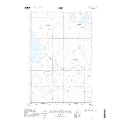
2020 Map of Lake Nettie
USGS Topo · Published 2020About this map
Audubon Lake and Lake Nettie anchor this section of McLean County, where the prairie landscape is defined by a dense network of glacial wetlands and sloughs. The geography is characterized by the section-line road grid, including Co Rd 23 and Co Rd 25, which navigate around significant water bodies like Crooked Lake and Nygaard Slough. For those tracing local heritage, the inclusion of Bethel Cem and Darling Cem provides specific points of historical interest in an otherwise agricultural landscape. The modern presence of the N-Country-National-Scenic-Trail winds through the southern half of the map, intersecting with Co Hwy 23 and highlighting how recreation now overlays the traditional township and range survey lines of T147N and T148N.
Find a feature on this map
37 named features on this map. Tap any name to fly to it.
Don’t see what you’re looking for? This feature index may not catch every label — zoom into the map to look around manually.
Map Details
Editions of this 2020 Lake Nettie Map
This is the sole edition of this map. No revisions or reprints were ever made.
Other maps of this area

1929 · Coleharbor
USGS Topo · 1:62,500

1947 · Turtle Lake
USGS Topo · 1:62,500

1949 · Turtle Creek
USGS Topo · 1:62,500

1949 · Washburn
USGS Topo · 1:62,500

1954 · McClusky
USGS Topo · 1:250,000

1958 · McClusky
USGS Topo · 1:250,000

1961 · Turtle Lake
USGS Topo · 1:24,000

1961 · Lake Nettie
USGS Topo · 1:24,000

1961 · Washburn NE
USGS Topo · 1:24,000

1961 · Turtle Creek NW
USGS Topo · 1:24,000