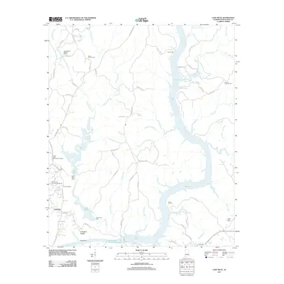
2011 Map of Lake Nicol
USGS Topo · Published 2011About this map
Holt Lake and the William Bacon Oliver Lake dominate this landscape northeast of Tuscaloosa, where the Black Warrior River system has been reshaped by significant water management projects. The map documents a complex network of reservoirs including Lake Nicol and Lake Harris, alongside their corresponding structures like the Lake Nicol Dam and Lake Harris Dam. These water bodies are fed by numerous tributaries such as Yellow Creek, Cypress Creek, and Rocky Branch. Residential developments like Lexington Downs and Lakeridge sit near the water's edge, while established sites like Camp Cherry Austin and several family-named burial grounds, including Scales Cemetery and Yellow Creek Cemetery, provide important touchstones for local genealogists and historians tracking the evolution of this riverside region.
Find a feature on this map
77 named features on this map. Tap any name to fly to it.
Don’t see what you’re looking for? This feature index may not catch every label — zoom into the map to look around manually.
Map Details
Editions of this 2011 Lake Nicol Map
This is the sole edition of this map. No revisions or reprints were ever made.
Other maps of this area

1899 · Brookwood
USGS Topo · 1:125,000

1924 · Tuscaloosa
USGS Topo · 1:62,500

1926 · Samantha
USGS Topo · 1:48,000

1926 · Tuscaloosa
USGS Topo · 1:62,500

1928 · Samantha
USGS Topo · 1:62,500

1929 · Searles
USGS Topo · 1:48,000

1931 · Cottondale
USGS Topo · 1:48,000

1934 · Searles
USGS Topo · 1:62,500

1934 · Cottondale
USGS Topo · 1:62,500

1953 · Birmingham
USGS Topo · 1:250,000
Featured Places
- Tuscaloosa, AL
- Grand Arbor, Tuscaloosa
- Shamley Green, Tuscaloosa
- Harbor Ridge, Tuscaloosa
- Signal Hill, Tuscaloosa