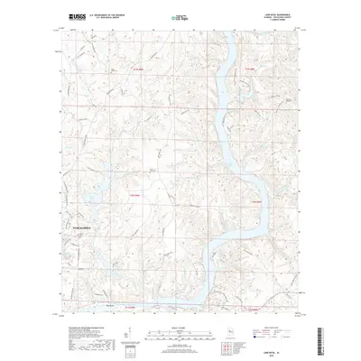
2018 Map of Lake Nicol
USGS Topo · Published 2018About this map
The northern reaches of Tuscaloosa are defined by a sophisticated network of reservoirs and creek valleys, where the Black Warrior River system forms expansive water bodies such as Holt Lake and William Bacon Oliver Lake. This 2018 survey reveals the intricate topography of the Warrior Basin, characterized by narrow ridges and deep drainages like Yellow Creek and Hurricane Creek. The landscape transition from urban expansion to managed forestry is evident in the winding paths of Watermelon Road and the scattered rural landmarks that anchor the area's history.
Find a feature on this map
87 named features on this map. Tap any name to fly to it.
Don’t see what you’re looking for? This feature index may not catch every label — zoom into the map to look around manually.
Map Details
Editions of this 2018 Lake Nicol Map
This is the sole edition of this map. No revisions or reprints were ever made.
Other maps of this area

1899 · Brookwood
USGS Topo · 1:125,000

1924 · Tuscaloosa
USGS Topo · 1:62,500

1926 · Samantha
USGS Topo · 1:48,000

1926 · Tuscaloosa
USGS Topo · 1:62,500

1928 · Samantha
USGS Topo · 1:62,500

1929 · Searles
USGS Topo · 1:48,000

1931 · Cottondale
USGS Topo · 1:48,000

1934 · Searles
USGS Topo · 1:62,500

1934 · Cottondale
USGS Topo · 1:62,500

1953 · Birmingham
USGS Topo · 1:250,000
Featured Places
- Tuscaloosa, AL
- Grand Arbor, Tuscaloosa
- Shamley Green, Tuscaloosa
- Harbor Ridge, Tuscaloosa
- Signal Hill, Tuscaloosa