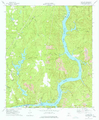
1974 Map of Lake Nicol
USGS Topo · Published 1974About this map
Black Warrior River dominates this mid-1970s landscape, illustrating the critical role of water management and energy production in Tuscaloosa County. The massive Holt Lock and Dam structure and its associated powerplant anchor the southern reaches, creating the reservoir known as Holt Lake. This waterway was a hub for industrial and recreational utility, evidenced by several public access points like the Rock Quarry Landing and the Old Lock 15. Inland, the terrain is marked by numerous strip mines, showing the extensive extractive industry active in the area at this time.
Find a feature on this map
53 named features on this map. Tap any name to fly to it.
Don’t see what you’re looking for? This feature index may not catch every label — zoom into the map to look around manually.
Map Details
Editions of this 1974 Lake Nicol Map
This is the sole edition of this map. No revisions or reprints were ever made.
Other maps of this area

1899 · Brookwood
USGS Topo · 1:125,000

1924 · Tuscaloosa
USGS Topo · 1:62,500

1926 · Samantha
USGS Topo · 1:48,000

1926 · Tuscaloosa
USGS Topo · 1:62,500

1928 · Samantha
USGS Topo · 1:62,500

1929 · Searles
USGS Topo · 1:48,000

1931 · Cottondale
USGS Topo · 1:48,000

1934 · Searles
USGS Topo · 1:62,500

1934 · Cottondale
USGS Topo · 1:62,500

1953 · Birmingham
USGS Topo · 1:250,000
Featured Places
- Tuscaloosa, AL
- Grand Arbor, Tuscaloosa
- Lakeridge, Tuscaloosa
- Signal Hill, Tuscaloosa
- Shamley Green, Tuscaloosa