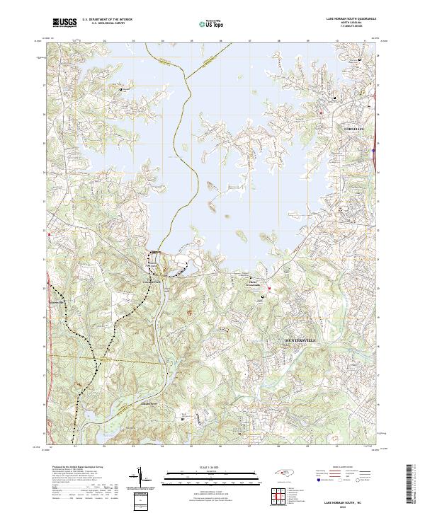
2022 Map of Lake Norman South
USGS Topo · Published 2022About this map
Lake Norman dominates the landscape of this 2022 survey, its multi-fingered shoreline defining the boundaries between Iredell, Lincoln, Gaston, and Mecklenburg counties. The area exhibits a pattern of suburban integration alongside deeply rooted local history, particularly evident in the high density of family and community burial grounds. From the Torrence Chapel Cem in the north to the Rural Hill Cem and Mount Olive Church Cem near the Catawba River, these sites preserve the names of early regional families. The modern growth of Huntersville and Cornelius contrasts with quieter nodes like Hicks Crossroads and the peninsula known as The Neck. Significant water features such as McDowell Creek and Ramsey Creek feed the larger reservoir, while Cowans Ford Island stands as a prominent landmark in the central channel.
Find a feature on this map
240 named features on this map. Tap any name to fly to it.
Don’t see what you’re looking for? This feature index may not catch every label — zoom into the map to look around manually.
Map Details
Editions of this 2022 Lake Norman South Map
This is the sole edition of this map. No revisions or reprints were ever made.
Other maps of this area

1893 · Statesville
USGS Topo · 1:125,000

1895 · Hickory
USGS Topo · 1:125,000

1914 · Gastonia
USGS Topo · 1:48,000

1916 · Gastonia
USGS Topo · 1:62,500

1941 · Charlotte
USGS Topo · 1:125,000

1942 · Charlotte
USGS Topo · 1:125,000

1948 · Paw Creek
USGS Topo · 1:24,000

1948 · Derita
USGS Topo · 1:24,000

1949 · Hicks Crossroads
USGS Topo · 1:24,000

1953 · Charlotte
USGS Topo · 1:250,000