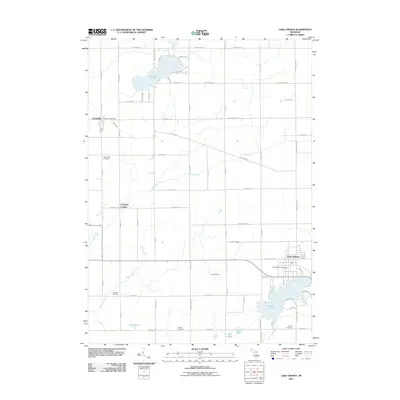
2011 Map of Lake Odessa
USGS Topo · Published 2011About this map
Jordan Lake serves as a focal point for this section of Ionia County, where the settlement of Lake Odessa sits along its northern shores. The landscape is defined by its glacial hydrology, featuring numerous water bodies like Morrison Lake and Duncan Lake alongside the winding Little Thornapple River. For genealogists and local historians, the sheet provides precise locations for family-named burial grounds including Dunkard Cemetery, Cheney Cemetery, and Mauch Cemetery. The rural character of the era is evidenced by the dispersed hamlets of Clarksville and Campbell Corners, connected by a grid of local routes such as Clinton Trl and Nash Hwy. The presence of both the Clarksville Post Office and Lake Odessa Post Office highlights these towns as the primary civic centers for the surrounding agricultural community.
Find a feature on this map
70 named features on this map. Tap any name to fly to it.
Don’t see what you’re looking for? This feature index may not catch every label — zoom into the map to look around manually.
Map Details
Editions of this 2011 Lake Odessa Map
This is the sole edition of this map. No revisions or reprints were ever made.
Other maps of this area

1916 · Ionia
USGS Topo · 1:62,500

1918 · Ionia
USGS Topo · 1:62,500

1918 · Lowell
USGS Topo · 1:62,500

1943 · Ionia
USGS Topo · 1:62,500

1943 · Lowell
USGS Topo · 1:62,500

1950 · Nashville
USGS Topo · 1:62,500

1951 · Nashville
USGS Topo · 1:62,500

1951 · Hastings
USGS Topo · 1:62,500

1958 · Grand Rapids
USGS Topo · 1:250,000

1961 · Grand Rapids
USGS Topo · 1:250,000