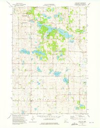
1973 Map of Lake Olaf
USGS Topo · Published 1975About this map
Glacial geology defines this landscape in the early 1970s, where hundreds of small depressions and kettle lakes create a complex terrain for the agricultural community of Norwegian Grove. The map reveals a deeply rooted Scandinavian heritage through its cultural landmarks, including the North Immanuel Cem, Norwegian Grove Cem, and South Immanuel Ch. This era shows a significant commitment to conservation with large tracts of land designated as the National Waterfowl Production Area, interspersed among private farms and family-named water bodies like Kopperud Lake and Granrud Lake. A quiet rural infrastructure is evident in the presence of several Gravel Pits and a small Landing Strip, supporting both the local economy and transportation. Larger basins such as Lake Olaf and Lake Jacobs provide recreational and natural focal points in a region dominated by township lines and field boundaries.
Find a feature on this map
29 named features on this map. Tap any name to fly to it.
Don’t see what you’re looking for? This feature index may not catch every label — zoom into the map to look around manually.
Map Details
Editions of this 1973 Lake Olaf Map
This is the sole edition of this map. No revisions or reprints were ever made.
Other maps of this area

1913 · Fergus Falls
USGS Topo · 1:62,500

1914 · Pelican Rapids
USGS Topo · 1:62,500

1917 · Pelican Rapids
USGS Topo · 1:62,500

1919 · Rothsay
USGS Topo · 1:62,500

1919 · Barnesville
USGS Topo · 1:62,500

1951 · Rothsay
USGS Topo · 1:62,500

1952 · Barnesville
USGS Topo · 1:62,500

1953 · Fargo
USGS Topo · 1:250,000

1956 · Fargo
USGS Topo · 1:250,000
1973 · Pelican Rapids
USGS Topo · 1:24,000