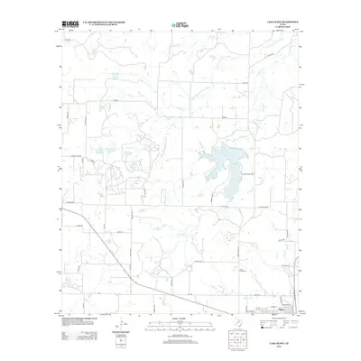
2012 Map of Lake Olney
USGS Topo · Published 2012About this map
The town of Olney occupies the southeastern corner of this Young County landscape, serving as a hub for the surrounding ranchlands and agricultural fields. This area is defined by a series of significant water management features, including the adjacent Lake Olney and Lake Cooper, as well as the more distant Megargel Cr Reservoir. These reservoirs, along with smaller bodies like Powell Lake and Furr Lake, support a network of creeks such as Bear Cr and Mesquite Cr that eventually feed into the S Fork Little Wichita River at the northern boundary. The terrain is crisscrossed by an extensive system of rural roads, many bearing family names like Darilek Rd, Benbritt Rd, and Wainscott Rd, which lead to local landmarks such as Saint Luke Cem. This layout reflects a modern Texas landscape where traditional ranching roots meet mid-century water infrastructure development.
Find a feature on this map
51 named features on this map. Tap any name to fly to it.
Don’t see what you’re looking for? This feature index may not catch every label — zoom into the map to look around manually.
Map Details
Editions of this 2012 Lake Olney Map
This is the sole edition of this map. No revisions or reprints were ever made.
Other maps of this area

1931 · Archer City
USGS Topo · 1:62,500

1932 · Dundee
USGS Topo · 1:62,500

1954 · Wichita Falls
USGS Topo · 1:250,000

1958 · Wichita Falls
USGS Topo · 1:250,000

1963 · Dundee SW
USGS Topo · 1:24,000

1963 · Megargel
USGS Topo · 1:24,000

1964 · Bobcat Bluff
USGS Topo · 1:24,000

1964 · Padgett
USGS Topo · 1:24,000

1964 · True
USGS Topo · 1:24,000

1964 · Dundee SE
USGS Topo · 1:24,000