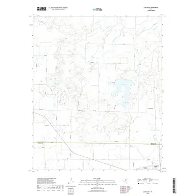
2019 Map of Lake Olney
USGS Topo · Published 2019About this map
Olney serves as the primary municipal center in this section of Young County, situated near the headwaters of several drainage systems. The landscape is defined by its water management history, featuring a series of catchments including Lake Olney, Lake Cooper, and the Megargel Cr Reservoir. These reservoirs, along with Powell Lake and Furr Lake, support the local agricultural and civic needs of this North Texas prairie region. The hydrology is dominated by the S Fork Little Wichita River and various tributaries such as Mesquite Cr and Salt Cr. Cultural and genealogical points of interest include Saint Luke Cem, located south of the county line. The terrain is crisscrossed by a network of rural roads, including FM 2178 and numerous family-named routes like Ben Britt Rd and Kunkel Rd, which outline the historical land divisions between Archer and Young counties.
Find a feature on this map
51 named features on this map. Tap any name to fly to it.
Don’t see what you’re looking for? This feature index may not catch every label — zoom into the map to look around manually.
Map Details
Editions of this 2019 Lake Olney Map
This is the sole edition of this map. No revisions or reprints were ever made.
Other maps of this area

1931 · Archer City
USGS Topo · 1:62,500

1932 · Dundee
USGS Topo · 1:62,500

1954 · Wichita Falls
USGS Topo · 1:250,000

1958 · Wichita Falls
USGS Topo · 1:250,000

1963 · Dundee SW
USGS Topo · 1:24,000

1963 · Megargel
USGS Topo · 1:24,000

1964 · Bobcat Bluff
USGS Topo · 1:24,000

1964 · Padgett
USGS Topo · 1:24,000

1964 · True
USGS Topo · 1:24,000

1964 · Dundee SE
USGS Topo · 1:24,000