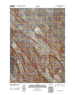
2011 Map of Lake on the Trail
USGS Topo · Published 2011About this map
Big Stick Creek defines the drainage of this high desert landscape in Harney County, flowing through a territory marked by seasonal water and volcanic features. In the early 21st century, this area remains a site of sparse connectivity, centered on the aptly named Lake on the Trail. This eponymous feature, along with Capehart Lake to the north, provides rare points of hydrological interest in a region where water often dictates the placement of transit routes. The presence of Big Stick Rd following the natural contours near the creek suggests the continued importance of historical travel corridors. To the southeast, the terrain drops into Black Canyon, illustrating the geological transition from the upland plateau into deeper drainage systems.
Find a feature on this map
5 named features on this map. Tap any name to fly to it.
Don’t see what you’re looking for? This feature index may not catch every label — zoom into the map to look around manually.
Map Details
Editions of this 2011 Lake on the Trail Map
This is the sole edition of this map. No revisions or reprints were ever made.
Other maps of this area

1955 · Burns
USGS Topo · 1:250,000

1958 · Burns
USGS Topo · 1:250,000

1959 · Burns
USGS Topo · 1:250,000

1979 · Moon Reservoir
USGS Topo · 1:24,000

1980 · Capehart Lake
USGS Topo · 1:24,000

1980 · Lunch Lake
USGS Topo · 1:24,000

1980 · Squaw Butte
USGS Topo · 1:24,000

1980 · Iron Mtn. Flat
USGS Topo · 1:24,000

1980 · Alec Butte
USGS Topo · 1:24,000

1980 · Lake on The Trail
USGS Topo · 1:24,000