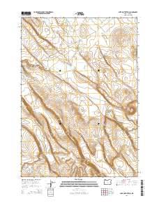
2014 Map of Lake on the Trail
USGS Topo · Published 2014About this map
Lake on the Trail and Capehart Lake anchor this arid Harney County landscape, where water features are the primary landmarks in an area dominated by high-desert plateaus and drainage systems. The map detail centers on the namesake lake and the seasonal flow of Big Stick Cr, which winds through the central and eastern portions of the quadrangle. The terrain is marked by significant topographical shifts, most notably at Black Canyon, where the elevation drops sharply toward the canyon floor. Human presence is defined by the long stretch of Big Stick Rd, which follows the natural contours of the land across multiple townships, including T25S R26E and T26S R27E. This 2014 survey documents the enduring spatial patterns of this remote region, illustrating how geography and limited water sources continue to dictate the placement of local infrastructure.
Find a feature on this map
11 named features on this map. Tap any name to fly to it.
Don’t see what you’re looking for? This feature index may not catch every label — zoom into the map to look around manually.
Map Details
Editions of this 2014 Lake on the Trail Map
This is the sole edition of this map. No revisions or reprints were ever made.
Other maps of this area

1955 · Burns
USGS Topo · 1:250,000

1958 · Burns
USGS Topo · 1:250,000

1959 · Burns
USGS Topo · 1:250,000

1979 · Moon Reservoir
USGS Topo · 1:24,000

1980 · Capehart Lake
USGS Topo · 1:24,000

1980 · Lunch Lake
USGS Topo · 1:24,000

1980 · Squaw Butte
USGS Topo · 1:24,000

1980 · Iron Mtn. Flat
USGS Topo · 1:24,000

1980 · Alec Butte
USGS Topo · 1:24,000

1980 · Lake on The Trail
USGS Topo · 1:24,000