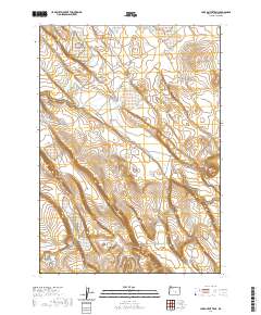
2020 Map of Lake on the Trail
USGS Topo · Published 2020About this map
Big Stick Cr winds through the high desert terrain of Harney County, Oregon, defining the drainage patterns of this sparsely populated landscape. The geography is characterized by the prominent Black Canyon, where steep contour intervals reveal the complex relief of the Oregon interior. Transportation in this remote area is limited to the single arterial route of Big Stick Rd, which follows the natural contours of the land across multiple townships. This 2020 survey documents the modern state of the public land survey system divisions, including t26s r26e and t26s r27e, illustrating how historical section lines continue to organize this high-altitude basin and range environment.
Find a feature on this map
9 named features on this map. Tap any name to fly to it.
Don’t see what you’re looking for? This feature index may not catch every label — zoom into the map to look around manually.
Map Details
Editions of this 2020 Lake on the Trail Map
This is the sole edition of this map. No revisions or reprints were ever made.
Other maps of this area

1955 · Burns
USGS Topo · 1:250,000

1958 · Burns
USGS Topo · 1:250,000

1959 · Burns
USGS Topo · 1:250,000

1979 · Moon Reservoir
USGS Topo · 1:24,000

1980 · Capehart Lake
USGS Topo · 1:24,000

1980 · Lunch Lake
USGS Topo · 1:24,000

1980 · Squaw Butte
USGS Topo · 1:24,000

1980 · Iron Mtn. Flat
USGS Topo · 1:24,000

1980 · Alec Butte
USGS Topo · 1:24,000

1980 · Lake on The Trail
USGS Topo · 1:24,000