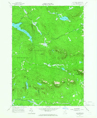
1964 Map of Lake Ozonia
USGS Topo · Published 1966About this map
Lake Ozonia dominates the western portion of this 1964 survey, showing the intricate network of water and mountains at the boundary of St Lawrence and Franklin counties. Situated within the Adirondack State Park, the landscape is defined by high points like Azure Mountain, which features a Lookout Tower, and the broad expanse of the State Forest Preserve. The map illustrates the specialized terrain of the northern Adirondacks, from the steep Stacy Bluff and Cat Hill to the wetlands of The Meadows. Small, isolated outposts such as Center Camp appear near the Ozonia Outlet, while a series of interconnected water bodies like Dexter Lake, Weller Pond, and Bens Pond suggest a region shaped by natural drainage and seasonal timber or recreational activity. The presence of several passes, including Eagle Pass, Deer Pass, and Arquett Pond Pass, highlights the established routes through these summits during the mid-20th century.
Find a feature on this map
49 named features on this map. Tap any name to fly to it.
Don’t see what you’re looking for? This feature index may not catch every label — zoom into the map to look around manually.
Map Details
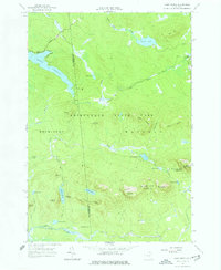
Editions of this 1964 Lake Ozonia Map
2 editions found
Other maps of this area

1905 · Saint Regis
USGS Topo · 1:62,500

1919 · Nicholville
USGS Topo · 1:62,500

1920 · Childwold
USGS Topo · 1:62,500

1921 · Childwold
USGS Topo · 1:48,000

1921 · Nicholville
USGS Topo · 1:62,500

1921 · Santa Clara
USGS Topo · 1:62,500

1922 · Childwold
USGS Topo · 1:62,500

1923 · Santa Clara
USGS Topo · 1:62,500

1948 · Ogdensburg
USGS Topo · 1:250,000

1951 · Ogdensburg
USGS Topo · 1:250,000