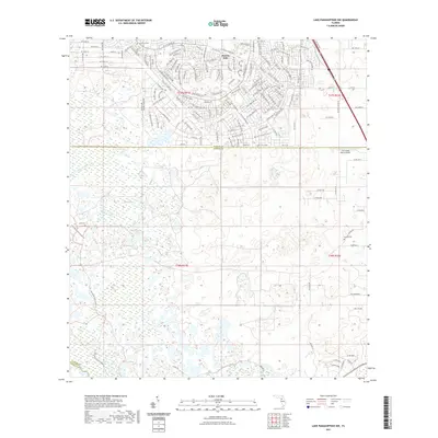
2021 Map of Lake Panasoffkee NW
USGS Topo · Published 2021About this map
Marion Oaks occupies the northern portion of this map, showcasing a dense network of residential streets that contrasts sharply with the wetlands to the south. The landscape is defined by the hydrologic complex of Gum Swamp, Gum Springs, and Gum Slough, which dominate the central and western sections of the terrain. This area reflects the characteristic transition from the upland residential developments of southern Marion County into the low-lying wet prairies and marshes typical of the region. Local history is anchored by the presence of Alto Cem in the west and Nichols Cem to the east. The southern reaches of the map extend across the county lines into Sumter Co and a corner of Citrus Co, where the land becomes increasingly rural and defined by natural drainage patterns rather than modern subdivisions.
Find a feature on this map
44 named features on this map. Tap any name to fly to it.
Don’t see what you’re looking for? This feature index may not catch every label — zoom into the map to look around manually.
Map Details
Editions of this 2021 Lake Panasoffkee NW Map
This is the sole edition of this map. No revisions or reprints were ever made.
Other maps of this area

1892 · Dunnellon
USGS Topo · 1:62,500

1893 · Panasoffkee
USGS Topo · 1:62,500

1894 · Dunnellon
USGS Topo · 1:62,500

1895 · Tsala Apopka
USGS Topo · 1:62,500

1895 · Panasoffkee
USGS Topo · 1:62,500

1895 · Ocala
USGS Topo · 1:62,500

1954 · Tsala Apopka NE
USGS Topo · 1:24,000

1954 · Inverness
USGS Topo · 1:24,000

1954 · Dunnellon SE
USGS Topo · 1:24,000

1954 · Inverness
USGS Topo · 1:62,500