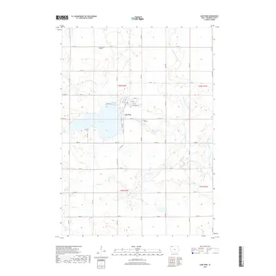
2018 Map of Lake Park
USGS Topo · Published 2018About this map
Lake Park sits prominently along the northern shore of Silver Lake, serving as a central hub for this portion of Dickinson County. The landscape is defined by the Coteau des Prairies, a vast plateau that shapes the hydrology of the region, where the headwaters of the Little Sioux River and its various branches, including the W Br Little Sioux River and the West Fork Little Sioux River, begin their southward journey. The map reveals a highly structured grid of section lines and county roads, such as Co RD a18, which navigate around natural features like Trappers Bay and Dugout Cr. For local historians, the placement of the Silver Lake Cem east of the main settlement and the street names like E Railroad Ave provide clear evidence of the town's historical development and orientation toward early transportation corridors.
Find a feature on this map
33 named features on this map. Tap any name to fly to it.
Don’t see what you’re looking for? This feature index may not catch every label — zoom into the map to look around manually.
Map Details
Editions of this 2018 Lake Park Map
This is the sole edition of this map. No revisions or reprints were ever made.
Other maps of this area

1954 · Fairmont
USGS Topo · 1:250,000

1958 · Fairmont
USGS Topo · 1:250,000

1960 · Round Lake
USGS Topo · 1:24,000

1960 · Sioux Valley
USGS Topo · 1:24,000

1970 · Milford
USGS Topo · 1:24,000

1970 · Lakefield SW
USGS Topo · 1:24,000

1970 · Okoboji
USGS Topo · 1:24,000

1970 · Lake Park SE
USGS Topo · 1:24,000

1970 · May City
USGS Topo · 1:24,000

1970 · Harris
USGS Topo · 1:24,000