
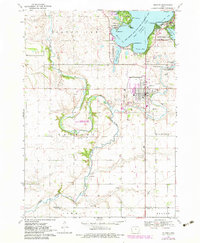
1970 Map of Milford
USGS Topo · Published 1972About this map
The glacial lakes of northwest Iowa dominate this landscape, where the town of Milford serves as a gateway to the southern reaches of the Spirit Lake region. The map details the intricate shoreline of West Okoboji Lake, revealing recreation and conservation areas such as Gull Point State Park and the Minnewashta Lake State Game Management Area. The transition from the aquatic environment of Emersons Bay and Garlock Slough to the agricultural plains is marked by the winding course of the Little Sioux River to the west.
Find a feature on this map
44 named features on this map. Tap any name to fly to it.
Don’t see what you’re looking for? This feature index may not catch every label — zoom into the map to look around manually.
Map Details
Editions of this 1970 Milford Map
2 editions found
Other maps of this area

1954 · Fairmont
USGS Topo · 1:250,000

1958 · Fairmont
USGS Topo · 1:250,000

1966 · Spencer
USGS Topo · 1:24,000

1966 · Dickens
USGS Topo · 1:24,000

1970 · Everly
USGS Topo · 1:24,000

1970 · Okoboji
USGS Topo · 1:24,000

1970 · Spirit Lake SE
USGS Topo · 1:24,000

1970 · Lake Park SE
USGS Topo · 1:24,000

1970 · Spirit Lake
USGS Topo · 1:24,000
1970 · Lake Park
USGS Topo · 1:24,000