
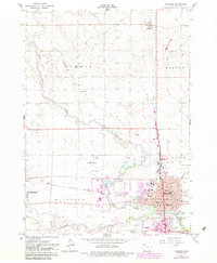
1966 Map of Spencer
USGS Topo · Published 1967About this map
The confluence of the Little Sioux River and the Ocheyedan River anchors the growing city of Spencer, depicted here during the mid-1960s. This industrial and transport hub in Clay County is defined by the intersection of the Chicago Milwaukee St Paul and Pacific and the Chicago and North Western railroads. The town's civic infrastructure is well-established, featuring Fairview School, Jefferson School, and a concentrated downtown district with a Courthouse, Hospital, and Sacred Heart Church.
Find a feature on this map
48 named features on this map. Tap any name to fly to it.
Don’t see what you’re looking for? This feature index may not catch every label — zoom into the map to look around manually.
Map Details
Editions of this 1966 Spencer Map
2 editions found
Other maps of this area

1954 · Fairmont
USGS Topo · 1:250,000

1958 · Fairmont
USGS Topo · 1:250,000

1966 · Gillett Grove
USGS Topo · 1:24,000

1966 · Greenville
USGS Topo · 1:24,000

1966 · Dickens
USGS Topo · 1:24,000

1970 · Milford
USGS Topo · 1:24,000

1970 · Everly
USGS Topo · 1:24,000

1970 · Royal
USGS Topo · 1:24,000

1970 · Spirit Lake SE
USGS Topo · 1:24,000

1970 · Lake Park SE
USGS Topo · 1:24,000