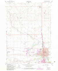
1966 Map of Spencer
USGS Topo · Published 1983About this map
The confluence of the Little Sioux River and the Ocheyedan River anchors this mid-century survey of Clay County, centered on the growing city of Spencer. The map documents a period of significant urban expansion, indicated by purple tinting that extends beyond the original 1966 city limits into surrounding townships like Sioux and Riverton. The Chicago Milwaukee St Paul and Pacific railroad bisects the landscape, serving as a critical artery for the region's agricultural economy.
Find a feature on this map
46 named features on this map. Tap any name to fly to it.
Don’t see what you’re looking for? This feature index may not catch every label — zoom into the map to look around manually.
Map Details
Editions of this 1966 Spencer Map
2 editions found
Other maps of this area

1954 · Fairmont
USGS Topo · 1:250,000

1958 · Fairmont
USGS Topo · 1:250,000

1966 · Spencer
USGS Topo · 1:24,000

1966 · Gillett Grove
USGS Topo · 1:24,000

1966 · Greenville
USGS Topo · 1:24,000

1966 · Dickens
USGS Topo · 1:24,000

1970 · Milford
USGS Topo · 1:24,000

1970 · Everly
USGS Topo · 1:24,000

1970 · Royal
USGS Topo · 1:24,000

1970 · Spirit Lake SE
USGS Topo · 1:24,000