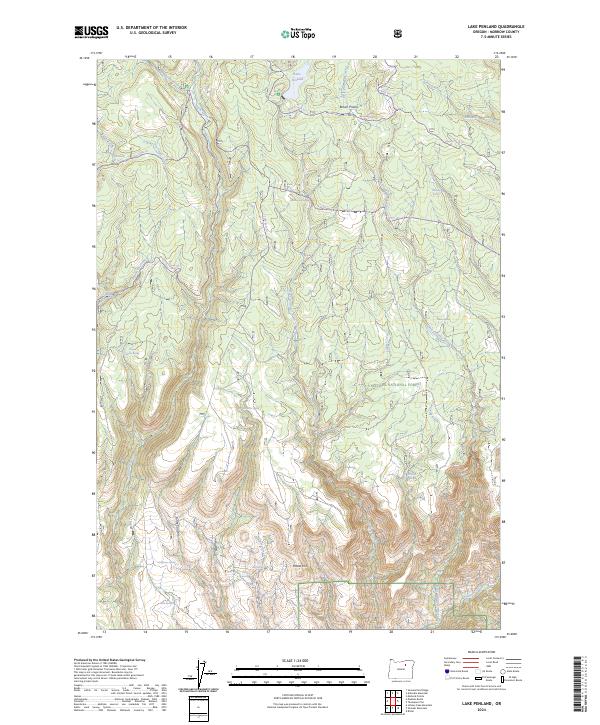
2024 Map of Lake Penland
USGS Topo · Published 2024About this map
Umatilla National Forest occupies a significant portion of this landscape in Morrow County, characterized by a complex network of canyons and upland springs. The namesake Lake Penland sits in the northern reaches, serving as a focal point above Brown Prairie. The terrain is deeply incised by drainages such as Potamus Creek and Little Potamus Creek, which define the local topography alongside the prominent rise of Potato Hill.
Find a feature on this map
39 named features on this map. Tap any name to fly to it.
Don’t see what you’re looking for? This feature index may not catch every label — zoom into the map to look around manually.
Map Details
Editions of this 2024 Lake Penland Map
This is the sole edition of this map. No revisions or reprints were ever made.
Other maps of this area

1950 · Ritter
USGS Topo · 1:62,500

1951 · Monument
USGS Topo · 1:62,500

1952 · Ritter
USGS Topo · 1:62,500

1953 · Pendleton
USGS Topo · 1:250,000

1955 · Canyon City
USGS Topo · 1:250,000

1956 · Pendleton
USGS Topo · 1:250,000

1959 · Canyon City
USGS Topo · 1:250,000

1969 · Summerfield Ridge
USGS Topo · 1:24,000

1969 · Lake Penland
USGS Topo · 1:24,000

1969 · Thompson Flat
USGS Topo · 1:24,000