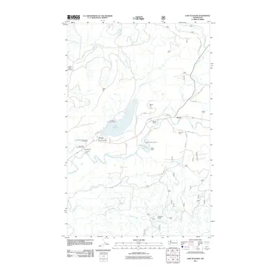
2011 Map of Lake Pleasant
USGS Topo · Published 2011About this map
Beaver and Sappho serve as the primary hubs in this Olympic Peninsula landscape, where the confluence of the Sol Duc River and various mountain creeks defines the local geography. The map documents a region heavily influenced by the timber and resource industries, evidenced by the numerous extraction sites such as the Sappho Quarry, Mary Clark Quarry, and the Beaver Sand and Gravel Quarry. Local infrastructure supports both the community and the environment, featuring the Beaver Post Office and the Soleduck Salmon Hatchery. The presence of large open spaces like Tyee Prairie and Beaver Prairie suggests a break in the dense forest canopy, providing distinct landmarks alongside the waters of Lake Pleasant. This 2011 record details the network of forest service roads, including the Olympic National Forest Rd, that permeate the hills between Tyee Hill and Calawah Ridge, mapping the modern footprint of these historic logging communities.
Find a feature on this map
41 named features on this map. Tap any name to fly to it.
Don’t see what you’re looking for? This feature index may not catch every label — zoom into the map to look around manually.
Map Details
Editions of this 2011 Lake Pleasant Map
This is the sole edition of this map. No revisions or reprints were ever made.
Other maps of this area

1922 · Pysht
USGS Topo · 1:62,500

1935 · Lake Pleasant
USGS Topo · 1:62,500

1939 · Forks
USGS Topo · 1:62,500

1942 · Pysht
USGS Topo · 1:62,500

1942 · Lake Pleasant
USGS Topo · 1:62,500

1943 · Spruce Mountain
USGS Topo · 1:62,500

1943 · Copalis Beach
USGS Topo · 1:250,000

1951 · Copalis Beach
USGS Topo · 1:250,000

1953 · Cape Flattery
USGS Topo · 1:250,000

1956 · Spruce Mtn.
USGS Topo · 1:62,500