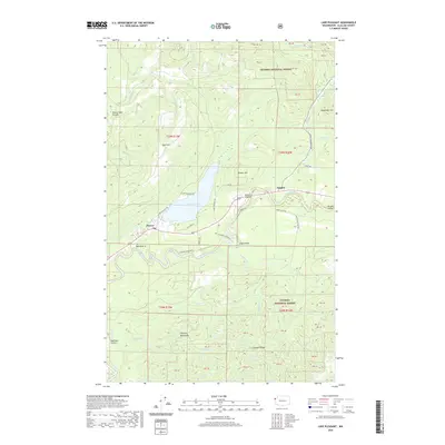
2020 Map of Lake Pleasant
USGS Topo · Published 2020About this map
Lake Pleasant sits at the heart of this landscape, surrounded by the dense timberlands of the Olympic National Forest in western Clallam County. The map documents a corridor of settlement along the Sol Duc River and Hoko River valleys, where the small communities of Beaver and Sappho serve as hubs for the surrounding logging and forest service roads. The geography is defined by a series of high ridges and open flats, including Tyee Prairie and Maxfield Prairie, which break up the rising slopes of the Olympic Mountains. Natural landmarks such as Beaver Falls and Eagle Point overlook a network of creeks including Shuwah Cr and Maxfield Cr. This survey illustrates the modern configuration of rural residential roads like Mary Clark Rd and Pavel Rd as they intersect with federal forest lands and state highways.
Find a feature on this map
57 named features on this map. Tap any name to fly to it.
Don’t see what you’re looking for? This feature index may not catch every label — zoom into the map to look around manually.
Map Details
Editions of this 2020 Lake Pleasant Map
This is the sole edition of this map. No revisions or reprints were ever made.
Other maps of this area

1922 · Pysht
USGS Topo · 1:62,500

1935 · Lake Pleasant
USGS Topo · 1:62,500

1939 · Forks
USGS Topo · 1:62,500

1942 · Pysht
USGS Topo · 1:62,500

1942 · Lake Pleasant
USGS Topo · 1:62,500

1943 · Spruce Mountain
USGS Topo · 1:62,500

1943 · Copalis Beach
USGS Topo · 1:250,000

1951 · Copalis Beach
USGS Topo · 1:250,000

1953 · Cape Flattery
USGS Topo · 1:250,000

1956 · Spruce Mtn.
USGS Topo · 1:62,500