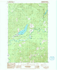
1984 Map of Lake Pleasant
USGS Topo · Published 1984About this map
Lake Pleasant and the surrounding timberlands of the Olympic National Forest define this 1984 survey of the Olympic Peninsula. The settlement of Sappho serves as a central point along the Soleduck River, where the Soleduck Valley opens into broad flats like Beaver Prairie and Tyee Prairie. This landscape reveals a legacy of resource management and early transport, evidenced by the Soleduck Salmon Hatchery and several segments of an Old Railroad Grade that once connected these forests to coastal mills.
Find a feature on this map
34 named features on this map. Tap any name to fly to it.
Don’t see what you’re looking for? This feature index may not catch every label — zoom into the map to look around manually.
Map Details
Editions of this 1984 Lake Pleasant Map
This is the sole edition of this map. No revisions or reprints were ever made.
Other maps of this area

1922 · Pysht
USGS Topo · 1:62,500

1935 · Lake Pleasant
USGS Topo · 1:62,500

1939 · Forks
USGS Topo · 1:62,500

1942 · Pysht
USGS Topo · 1:62,500

1942 · Lake Pleasant
USGS Topo · 1:62,500

1943 · Spruce Mountain
USGS Topo · 1:62,500

1943 · Copalis Beach
USGS Topo · 1:250,000

1951 · Copalis Beach
USGS Topo · 1:250,000

1953 · Cape Flattery
USGS Topo · 1:250,000

1956 · Spruce Mtn.
USGS Topo · 1:62,500