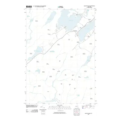
2010 Map of Lake Pleasant
USGS Topo · Published 2010About this map
Lake Pleasant serves as a central hub for this Adirondack landscape, where the settlements of Sacandaga Camp and Camp Agaming reflect a long history of lakeside recreation and seasonal residence. The area is defined by its interconnected water systems, from the expansive Sacandaga Lake in the north to the West Branch Sacandaga River winding along the southern boundary. Local history is anchored by the Fish Mountain Cemetery and South Side Lake Cemetery, which provide vital genealogical links for the community.
Find a feature on this map
71 named features on this map. Tap any name to fly to it.
Don’t see what you’re looking for? This feature index may not catch every label — zoom into the map to look around manually.
Map Details
Editions of this 2010 Lake Pleasant Map
This is the sole edition of this map. No revisions or reprints were ever made.
Other maps of this area

1899 · Indian Lake
USGS Topo · 1:62,500

1900 · Canada Lake
USGS Topo · 1:62,500

1902 · Indian Lake
USGS Topo · 1:62,500

1903 · West Canada Lakes
USGS Topo · 1:62,500

1904 · Piseco Lake
USGS Topo · 1:62,500

1906 · Piseco Lake
USGS Topo · 1:62,500

1907 · Lake Pleasant
USGS Topo · 1:62,500

1908 · Piseco Lake
USGS Topo · 1:62,500

1950 · Utica
USGS Topo · 1:250,000

1954 · Lake Pleasant
USGS Topo · 1:62,500