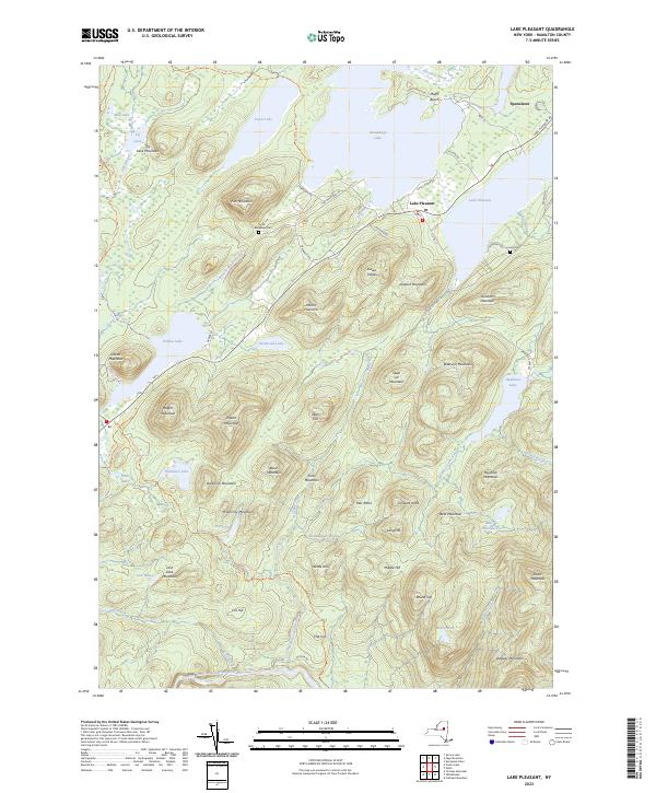
2023 Map of Lake Pleasant
USGS Topo · Published 2023About this map
The village of Speculator and the neighboring community of Lake Pleasant serve as the primary human centers in this landscape of interconnected waters and high peaks. The terrain is defined by massive glacial lakes and a complex network of wetlands like Priests Vly and Dead Vly, separated by prominent elevations such as Fish Mountain and Dunham Mountain. The distribution of residential roads and cemeteries, including Fish Mountain Cem and Love's Cem, reveals a settlement pattern concentrated along the shorelines of Sacandaga Lake and its namesake neighbor.
Find a feature on this map
82 named features on this map. Tap any name to fly to it.
Don’t see what you’re looking for? This feature index may not catch every label — zoom into the map to look around manually.
Map Details
Editions of this 2023 Lake Pleasant Map
This is the sole edition of this map. No revisions or reprints were ever made.
Other maps of this area

1899 · Indian Lake
USGS Topo · 1:62,500

1900 · Canada Lake
USGS Topo · 1:62,500

1902 · Indian Lake
USGS Topo · 1:62,500

1903 · West Canada Lakes
USGS Topo · 1:62,500

1904 · Piseco Lake
USGS Topo · 1:62,500

1906 · Piseco Lake
USGS Topo · 1:62,500

1907 · Lake Pleasant
USGS Topo · 1:62,500

1908 · Piseco Lake
USGS Topo · 1:62,500

1950 · Utica
USGS Topo · 1:250,000

1954 · Lake Pleasant
USGS Topo · 1:62,500