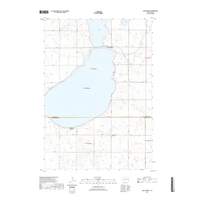
2017 Map of Lake Poinsett
USGS Topo · Published 2017About this map
Lake Poinsett dominates this landscape, sitting at the junction of Hamlin and Brookings counties. This large glacial water body is a central geographical fixture on the Coteau des Prairies plateau, surrounded by a grid of rural roads and the shoreline settlement of Arlington Beach. The map details the local road network connecting seasonal residences and agricultural land, including NW Lake Dr and SE Lake Dr which ring the lake. Notable local landmarks include the Stone Bridge crossing on the lake's northern end and the Bakke Cem located just off E Lake Dr. The survey captures the contrast between the open water and the wetland-studded prairie to the south, highlighting the region's importance for local recreation and its enduring rural character.
Find a feature on this map
31 named features on this map. Tap any name to fly to it.
Don’t see what you’re looking for? This feature index may not catch every label — zoom into the map to look around manually.
Map Details
Editions of this 2017 Lake Poinsett Map
This is the sole edition of this map. No revisions or reprints were ever made.
Other maps of this area

1953 · Watertown
USGS Topo · 1:250,000

1958 · Watertown
USGS Topo · 1:250,000

1968 · Bruce
USGS Topo · 1:24,000

1968 · Arlington NE
USGS Topo · 1:24,000

1968 · Badger
USGS Topo · 1:24,000

1969 · Hayti
USGS Topo · 1:24,000

1969 · Dempster
USGS Topo · 1:24,000

1969 · Castlewood
USGS Topo · 1:24,000

1969 · Lake Norden
USGS Topo · 1:24,000

1969 · Lake Poinsett
USGS Topo · 1:24,000