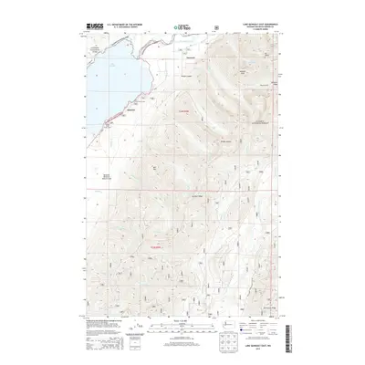
2014 Map of Lake Quinault East
USGS Topo · Published 2014About this map
Lake Quinault serves as the focal point for this section of the Olympic Peninsula, where the glacial waters meet the heavily timbered slopes of the Olympic National Forest. The small settlement of Quinault sits along the southern shore, acting as a gateway for travelers moving between the lake and the high country of Olympic National Park to the north. This 2014 survey documents the established recreational and research infrastructure within the valley, including the Falls Creek Forest Camp and the Willaby Creek Forest Camp, both nestled near their respective tributary streams.
Find a feature on this map
40 named features on this map. Tap any name to fly to it.
Don’t see what you’re looking for? This feature index may not catch every label — zoom into the map to look around manually.
Map Details
Editions of this 2014 Lake Quinault East Map
This is the sole edition of this map. No revisions or reprints were ever made.
Other maps of this area

1921 · Quinault Lake
USGS Topo · 1:62,500

1921 · Satsop
USGS Topo · 1:62,500

1947 · Mt Christie
USGS Topo · 1:62,500

1950 · Mt Christie
USGS Topo · 1:62,500

1955 · Grisdale
USGS Topo · 1:62,500

1955 · Quinault Lake
USGS Topo · 1:62,500

1956 · Kloochman Rock
USGS Topo · 1:62,500

1958 · Seattle
USGS Topo · 1:250,000

1962 · Seattle
USGS Topo · 1:250,000
1988 · Shelton
USGS Topo · 1:100,000