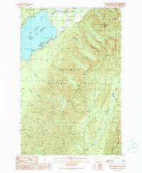
1990 Map of Lake Quinault East
USGS Topo · Published 1990About this map
Lake Quinault serves as the focal point for this landscape where the Quinault Indian Reservation meets the protected reaches of the Olympic National Park. The settlement of Quinault sits along the southern shore, acting as a gateway for the recreation and administrative infrastructure of the late twentieth century, including a Ranger Station and multiple lakeside sites like Willaby Creek Campground and July Creek Campground. To the east, the terrain rises sharply into the Olympic Ridge and the Colonel Bob Wilderness, characterized by dramatic peaks such as Wooded Peak and Mount O'Neil. Drainage patterns are defined by the Quinault River and the West Fork Humptulips River, with numerous named tributaries like Ziegler Creek and Gatton Creek carving through the heavy timber of the Olympic National Forest.
Find a feature on this map
43 named features on this map. Tap any name to fly to it.
Don’t see what you’re looking for? This feature index may not catch every label — zoom into the map to look around manually.
Map Details
Editions of this 1990 Lake Quinault East Map
This is the sole edition of this map. No revisions or reprints were ever made.
Other maps of this area

1921 · Quinault Lake
USGS Topo · 1:62,500

1921 · Satsop
USGS Topo · 1:62,500

1947 · Mt Christie
USGS Topo · 1:62,500

1950 · Mt Christie
USGS Topo · 1:62,500

1955 · Grisdale
USGS Topo · 1:62,500

1955 · Quinault Lake
USGS Topo · 1:62,500

1956 · Kloochman Rock
USGS Topo · 1:62,500

1958 · Seattle
USGS Topo · 1:250,000

1962 · Seattle
USGS Topo · 1:250,000
1988 · Shelton
USGS Topo · 1:100,000