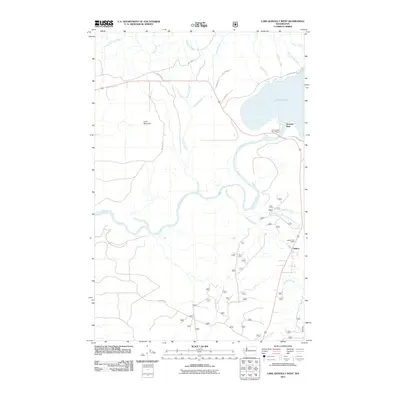
2011 Map of Lake Quinault West
USGS Topo · Published 2011About this map
Lake Quinault serves as the focal point of this western Washington landscape, where the Quinault River winds through a complex network of glacial and alluvial drainages. The small community of Amanda Park sits near the lakeshore, anchored by the Amanda Park Post Office, while the settlement of Neilton is situated further south along the main transit corridor. This survey documents a transition from the lakeside environment to the rising terrain of Lone Mountain to the west, illustrating the connection between the water-rich valley floor and the surrounding timberlands.
Find a feature on this map
28 named features on this map. Tap any name to fly to it.
Don’t see what you’re looking for? This feature index may not catch every label — zoom into the map to look around manually.
Map Details
Editions of this 2011 Lake Quinault West Map
This is the sole edition of this map. No revisions or reprints were ever made.
Other maps of this area

1921 · Quinault Lake
USGS Topo · 1:62,500

1943 · Copalis Beach
USGS Topo · 1:250,000

1951 · Copalis Beach
USGS Topo · 1:250,000

1955 · Macafee Hill
USGS Topo · 1:62,500

1955 · Quinault Lake
USGS Topo · 1:62,500

1956 · Kloochman Rock
USGS Topo · 1:62,500

1956 · Salmon River
USGS Topo · 1:62,500

1957 · Copalis Beach
USGS Topo · 1:250,000

1958 · Seattle
USGS Topo · 1:250,000

1962 · Seattle
USGS Topo · 1:250,000