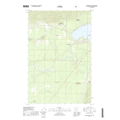
2020 Map of Lake Quinault West
USGS Topo · Published 2020About this map
Lake Quinault anchors this coastal Washington landscape, where the Quinault River flows through a dense network of timberlands and protected wilderness. The settlements of Amanda Park and Neilton serve as small hubs for the region, positioned near the boundary where Olympic National Park meets Olympic National Forest. The topography is defined by the transition from the river valley flats to significant rises such as Thimble Mtn and Lone Mtn, while Chow Chow Prairie occupies the southwest corner. Local transport is represented by the Hass Road and Bia RD F-15, which thread through the forest to reach secluded water bodies like Pope Lake. This 2020 record documents the modern boundaries and naming of numerous drainages, including Boulder Cr and the uniquely named Grindstone Cr, illustrating the hydrography of the Olympic Peninsula.
Find a feature on this map
31 named features on this map. Tap any name to fly to it.
Don’t see what you’re looking for? This feature index may not catch every label — zoom into the map to look around manually.
Map Details
Editions of this 2020 Lake Quinault West Map
This is the sole edition of this map. No revisions or reprints were ever made.
Other maps of this area

1921 · Quinault Lake
USGS Topo · 1:62,500

1943 · Copalis Beach
USGS Topo · 1:250,000

1951 · Copalis Beach
USGS Topo · 1:250,000

1955 · Macafee Hill
USGS Topo · 1:62,500

1955 · Quinault Lake
USGS Topo · 1:62,500

1956 · Kloochman Rock
USGS Topo · 1:62,500

1956 · Salmon River
USGS Topo · 1:62,500

1957 · Copalis Beach
USGS Topo · 1:250,000

1958 · Seattle
USGS Topo · 1:250,000

1962 · Seattle
USGS Topo · 1:250,000