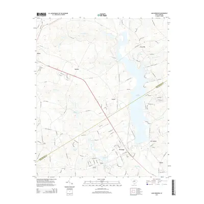
2014 Map of Lake Robinson
USGS Topo · Published 2014About this map
Lake Robinson serves as a central geographic feature in this part of South Carolina, straddling the line between Chesterfield Co and Darlington Co. The landscape is defined by its extensive water network, including Beaverdam Creek, which feeds into Beaverdam Millpond and Kington Lake. Near the settlement of Clyde, Saint Pauls Cemetery provides a focal point for genealogical interest, as do Union Cemetery and McLean Cemetery to the west.
Find a feature on this map
123 named features on this map. Tap any name to fly to it.
Don’t see what you’re looking for? This feature index may not catch every label — zoom into the map to look around manually.
Map Details
Editions of this 2014 Lake Robinson Map
This is the sole edition of this map. No revisions or reprints were ever made.
Other maps of this area

1941 · Spartanburg
USGS Topo · 1:250,000

1953 · Spartanburg
USGS Topo · 1:250,000

1960 · Spartanburg
USGS Topo · 1:250,000

1963 · Spartanburg
USGS Topo · 1:250,000

1964 · Spartanburg
USGS Topo · 1:250,000

1967 · Angelus
USGS Topo · 1:24,000

1968 · Patrick
USGS Topo · 1:24,000

1968 · Middendorf
USGS Topo · 1:24,000
1968 · Hartsville North
USGS Topo · 1:24,000
1968 · Lake Robinson
USGS Topo · 1:24,000