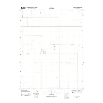
2012 Map of Lake Scott SE
USGS Topo · Published 2012About this map
W Salt Cr cuts through the northeastern corner of this landscape, representing one of the few natural hydrographic breaks in a region defined by an orderly grid of section-line roads. The vast agricultural character of Scott County is evident in the systematic layout of routes such as N Navaho Rd, N Pawnee Rd, and N Rodeo Rd. Occasional structures and farmsteads appear along east-west thoroughfares like E Road 200 and E Road 210, indicating the sparse but persistent human footprint on the High Plains. Small depressions and catchments are scattered throughout the quadrangle, which lacks any major named settlements, reflecting the specialized rural nature of the area in the early twenty-first century.
Find a feature on this map
13 named features on this map. Tap any name to fly to it.
Don’t see what you’re looking for? This feature index may not catch every label — zoom into the map to look around manually.
Map Details
Editions of this 2012 Lake Scott SE Map
This is the sole edition of this map. No revisions or reprints were ever made.
Other maps of this area

1939 · Lake Mc Bride
USGS Topo · 1:24,000

1939 · Sandon
USGS Topo · 1:62,500

1940 · Scott City
USGS Topo · 1:62,500

1942 · Sandon
USGS Topo · 1:62,500

1942 · Lake Mc Bride
USGS Topo · 1:31,680

1951 · Scott City
USGS Topo · 1:62,500

1955 · Scott City
USGS Topo · 1:250,000

1958 · Scott City
USGS Topo · 1:250,000

1974 · Healy NW
USGS Topo · 1:24,000

1974 · Grigston
USGS Topo · 1:24,000