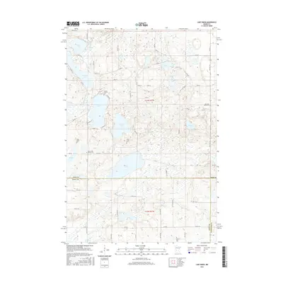
2016 Map of Lake Simon
USGS Topo · Published 2016About this map
The Lake Simon region where the borders of Pope, Swift, and Kandiyohi Counties meet is a landscape defined by glacial depressions and historic rural gathering places. Small cemeteries are scattered throughout the countryside, often bearing the names of the families or congregations that settled this part of Minnesota, such as the Hitman Family Cem and the Scandia Lutheran Cem. The topography is dominated by a complex network of wetlands and open water, with Scandinavian Lake and Goose Lake feeding into local drainage systems like Mud Cr. Transport in the area relies on a grid of township roads and county highways, including State Hwy 104 and Co Rd 84, which navigate around the irregular shorelines of Nilson Lake and Johnson Lake. This survey illustrates the persistence of small-scale family landmarks in a modern agricultural and lacustrine environment.
Find a feature on this map
69 named features on this map. Tap any name to fly to it.
Don’t see what you’re looking for? This feature index may not catch every label — zoom into the map to look around manually.
Map Details
Editions of this 2016 Lake Simon Map
This is the sole edition of this map. No revisions or reprints were ever made.
Other maps of this area

1953 · Saint Cloud
USGS Topo · 1:250,000

1957 · Saint Cloud
USGS Topo · 1:250,000

1958 · Saint Cloud
USGS Topo · 1:250,000

1965 · Sedan
USGS Topo · 1:24,000

1967 · Sunburg
USGS Topo · 1:24,000

1967 · Lake Johanna
USGS Topo · 1:24,000

1968 · De Graff
USGS Topo · 1:24,000

1968 · Terrace
USGS Topo · 1:24,000

1968 · Lake Simon
USGS Topo · 1:24,000
1968 · Lake Minnewaska
USGS Topo · 1:24,000