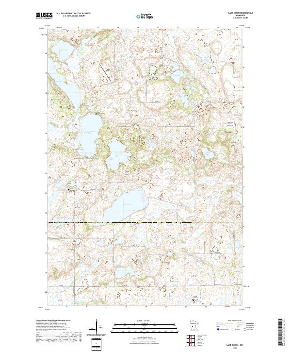
2022 Map of Lake Simon
USGS Topo · Published 2022About this map
The aquatic landscape of Lake Simon and Scandinavian Lake anchors this mapping of the glacial prairie region where Pope, Swift, and Kandiyohi Counties meet. The terrain is defined by a dense concentration of wetlands and small water bodies, including Goose Lake, Nilson Lake, and Gilchrist Lake, which feed into the E Br Chippewa River and various tributaries like Mud Cr. This environment shaped a rural settlement pattern centered on family legacies and faith communities, evidenced by the numerous small cemeteries that dot the landscape.
Find a feature on this map
55 named features on this map. Tap any name to fly to it.
Don’t see what you’re looking for? This feature index may not catch every label — zoom into the map to look around manually.
Map Details
Editions of this 2022 Lake Simon Map
This is the sole edition of this map. No revisions or reprints were ever made.
Other maps of this area

1953 · Saint Cloud
USGS Topo · 1:250,000

1957 · Saint Cloud
USGS Topo · 1:250,000

1958 · Saint Cloud
USGS Topo · 1:250,000

1965 · Sedan
USGS Topo · 1:24,000

1967 · Sunburg
USGS Topo · 1:24,000

1967 · Lake Johanna
USGS Topo · 1:24,000

1968 · De Graff
USGS Topo · 1:24,000

1968 · Terrace
USGS Topo · 1:24,000

1968 · Lake Simon
USGS Topo · 1:24,000
1968 · Lake Minnewaska
USGS Topo · 1:24,000