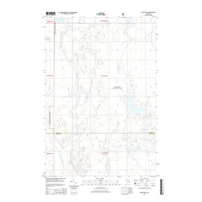
2014 Map of Lake Stella
USGS Topo · Published 2014About this map
The Hiawatha National Forest dominates this northern Michigan landscape, where the border of Alger County and Delta County cuts through a dense network of glacial lakes and river headwaters. In the northern reaches, the Cleveland Cliffs Basin and Paquette Lake sit near the upper Sturgeon River, while the southern terrain is defined by the winding course of the East Branch Whitefish River. This 2014 survey reveals a transition between deep forest tracts and the water-rich lowlands of the Upper Peninsula. Numerous smaller water bodies like Little Pole Lake, Saul Lake, and Trout Lake are connected by seasonal drainages such as Squirrel Cr and Cherry Cr. The map provides a look at the hydrography of the region just before recent changes in forest management and road classifications, documenting the established forest service routes that provide access to remote areas like Upper Eighteenmile Lake and Pole Creek Lake.
Find a feature on this map
34 named features on this map. Tap any name to fly to it.
Don’t see what you’re looking for? This feature index may not catch every label — zoom into the map to look around manually.
Map Details
Editions of this 2014 Lake Stella Map
This is the sole edition of this map. No revisions or reprints were ever made.
Other maps of this area

1932 · Trenary SW
USGS Topo · 1:31,680

1932 · Trenary SE
USGS Topo · 1:31,680

1932 · Skeels Lake NW and SW
USGS Topo · 1:31,680

1958 · Corner Lake
USGS Topo · 1:62,500

1958 · Trenary
USGS Topo · 1:62,500

1958 · Munising
USGS Topo · 1:62,500

1958 · Au Train
USGS Topo · 1:62,500

1958 · Marquette
USGS Topo · 1:250,000

1960 · Marquette
USGS Topo · 1:250,000

1961 · Marquette
USGS Topo · 1:250,000
Featured Places
- Au Train Township, MI
- Mathias Township, MI
- Nahma Township, MI
- Limestone Township, MI
- Masonville Township, MI