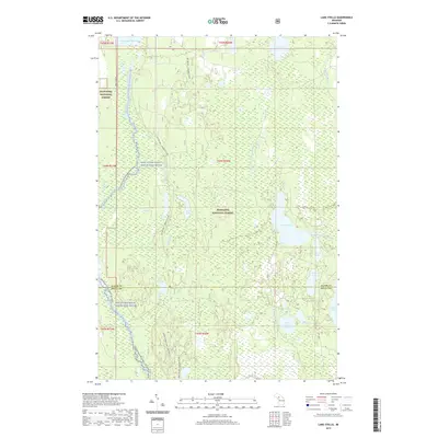
2019 Map of Lake Stella
USGS Topo · Published 2019About this map
The Hiawatha National Forest dominates this Central Upper Peninsula landscape, where water and wood have long shaped the local economy. In the northern reaches, the Cleveland Cliffs Basin stands as a significant hydrological feature, while the protected Whitefish Wild and Scenic River corridor winds southward through dense timberlands. The map reveals a complex network of small lakes and seasonal streams, including Lake Stella, Stoner Lake, and Bass Lake, which are characteristic of the glaciated terrain in this part of Michigan. The boundary between Alger and Delta counties bisects the southern portion of the sheet, marking a divide in local administrative history. Evidence of the region’s recreational and conservation focus is visible through features like the Whitefish River Canoe E-Br (Water) and the Upper 18 Mile Lake Loop Bdy, reflecting the transition of these lands from intensive industrial timber production to managed multi-use forest.
Find a feature on this map
32 named features on this map. Tap any name to fly to it.
Don’t see what you’re looking for? This feature index may not catch every label — zoom into the map to look around manually.
Map Details
Editions of this 2019 Lake Stella Map
This is the sole edition of this map. No revisions or reprints were ever made.
Other maps of this area

1932 · Trenary SW
USGS Topo · 1:31,680

1932 · Trenary SE
USGS Topo · 1:31,680

1932 · Skeels Lake NW and SW
USGS Topo · 1:31,680

1958 · Corner Lake
USGS Topo · 1:62,500

1958 · Trenary
USGS Topo · 1:62,500

1958 · Munising
USGS Topo · 1:62,500

1958 · Au Train
USGS Topo · 1:62,500

1958 · Marquette
USGS Topo · 1:250,000

1960 · Marquette
USGS Topo · 1:250,000

1961 · Marquette
USGS Topo · 1:250,000
Featured Places
- Au Train Township, MI
- Mathias Township, MI
- Nahma Township, MI
- Limestone Township, MI
- Masonville Township, MI