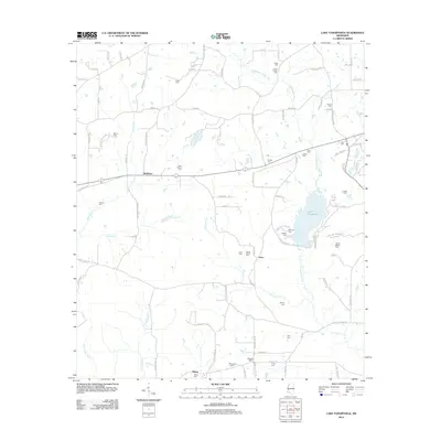
2012 Map of Lake Tangipahoa
USGS Topo · Published 2012About this map
Lake Tangipahoa serves as the central focal point of this landscape, fed by the Tangipahoa River as it flows south through the eastern portion of the quadrangle. The surrounding terrain is defined by a dense network of country roads and family-named landmarks, reflecting the rural settlement patterns of Pike County. To the west, the Tickfaw River and its branches, including the W Br Tickfaw River, drain the lower reaches of the map near the small community of Mixon.
Find a feature on this map
90 named features on this map. Tap any name to fly to it.
Don’t see what you’re looking for? This feature index may not catch every label — zoom into the map to look around manually.
Map Details
Editions of this 2012 Lake Tangipahoa Map
This is the sole edition of this map. No revisions or reprints were ever made.
Other maps of this area

1953 · Natchez
USGS Topo · 1:250,000

1956 · Natchez
USGS Topo · 1:250,000

1959 · Natchez
USGS Topo · 1:250,000

1972 · Smithdale
USGS Topo · 1:24,000
1972 · Osyka
USGS Topo · 1:24,000

1972 · Auburn
USGS Topo · 1:24,000

1972 · McComb South
USGS Topo · 1:24,000

1972 · Peoria
USGS Topo · 1:24,000

1972 · Lake Tangipahoa
USGS Topo · 1:24,000
1972 · McComb North
USGS Topo · 1:24,000