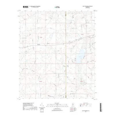
2018 Map of Lake Tangipahoa
USGS Topo · Published 2018About this map
Lake Tangipahoa sits as the central geographic focal point of this region, which straddles the line between Amite Co and Pike Co. The landscape is defined by the winding paths of the Tangipahoa River and Tickfaw River, with numerous tributaries like Jenkins Cr and Hurricane Cr carving through the terrain. Small communities such as McElveen, Irene, and Mixon anchor the rural road network, which is dominated by local routes like Old Hy 24 and Percy Quin Dr.
Find a feature on this map
88 named features on this map. Tap any name to fly to it.
Don’t see what you’re looking for? This feature index may not catch every label — zoom into the map to look around manually.
Map Details
Editions of this 2018 Lake Tangipahoa Map
This is the sole edition of this map. No revisions or reprints were ever made.
Other maps of this area

1953 · Natchez
USGS Topo · 1:250,000

1956 · Natchez
USGS Topo · 1:250,000

1959 · Natchez
USGS Topo · 1:250,000

1972 · Smithdale
USGS Topo · 1:24,000
1972 · Osyka
USGS Topo · 1:24,000

1972 · Auburn
USGS Topo · 1:24,000

1972 · McComb South
USGS Topo · 1:24,000

1972 · Peoria
USGS Topo · 1:24,000

1972 · Lake Tangipahoa
USGS Topo · 1:24,000
1972 · McComb North
USGS Topo · 1:24,000